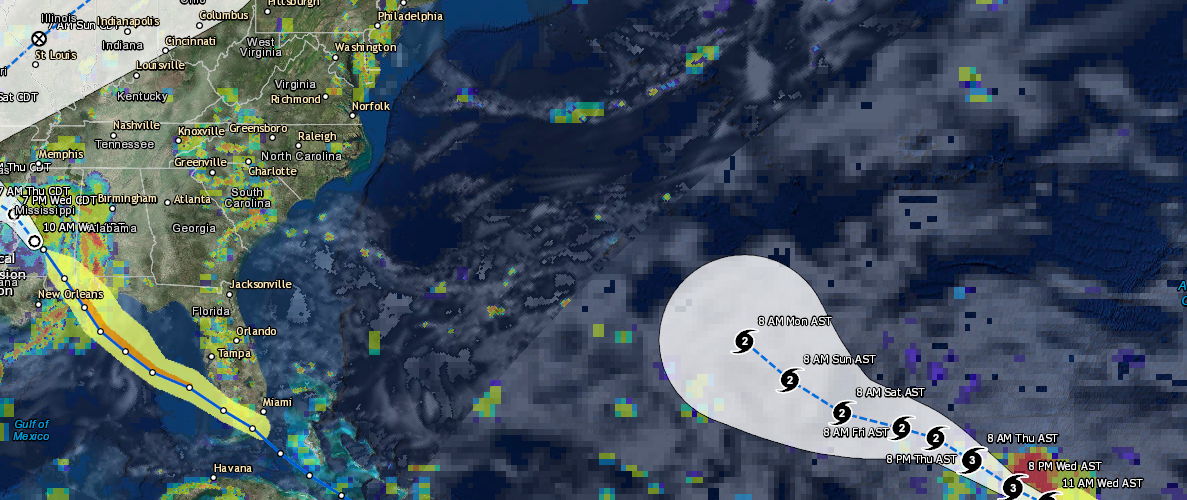
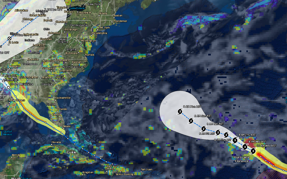
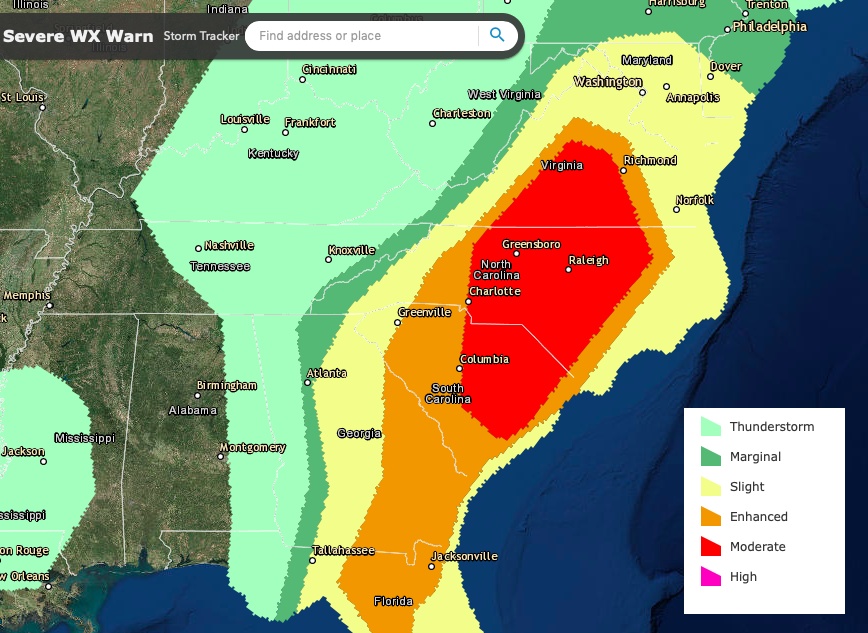
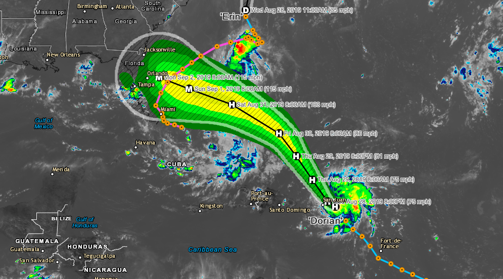
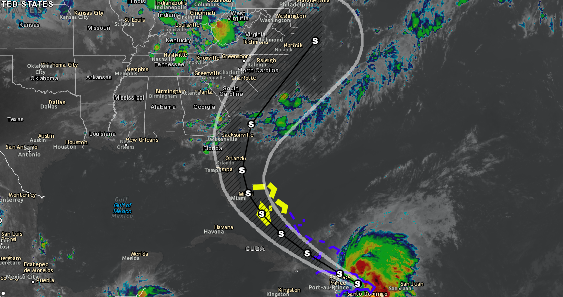
As of 11 a.m. Hurricane Florence is now a Major Atlantic Hurricane with maximum sustained winds of 125 MPH and a minimum central pressure of 957 MB. Florence is moving toward the northwest near 13 mph, and this general motion is expected to continue through tonight.  A turn toward the west-northwest with a decrease in forward speed is forecast on Thursday, followed by a turn back toward the northwest early next week. Florence is a category 3 hurricane on the Saffir-Simpson Hurricane Wind Scale. Some weakening is possible during the next few days, but Florence is expected to remain a strong hurricane through early next week. Hurricane-force winds extend outward up to 15 miles from the center, and tropical-storm-force winds extend outward up to 90 miles.

Bermuda and the east coast of the US should keep a close eye on this storm as it progresses this week into the beginning of next week.  The storm is expected to approach Bermuda on Tuesday and could possibly pose a threat to the Eastern United States late next week, though it is too far out to know for sure.  We will continually provide updates over the next few days.

Be sure to download our Hurricane Tracker which is available on Android, Apple and Web.
Atlantic Hurricane Tracker – Apps on Google Play
Atlantic Hurricane Tracker is am interactive mapping application for tracking hurricanes, tropical storms and tropical depressions in the Atlantic ocean. All data comes from the NHC, NOAA and NWS. Listed below are the featured layers of this application.
Atlantic Hurricane Tracker
Atlantic Hurricane Tracker is am interactive mapping application for tracking hurricanes, tropical storms and tropical depressions in the Atlantic ocean. All data comes from the NHC, NOAA and NWS. Listed below are the featured layers of this application. -Global Cloud Cover -Hurricane Tracks -NHC…