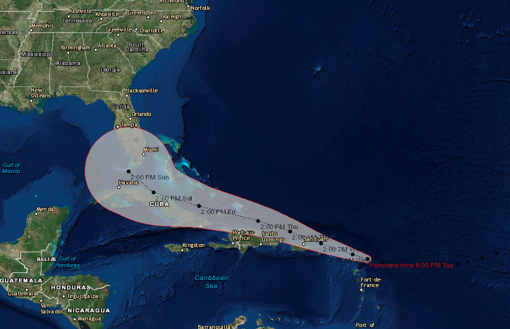
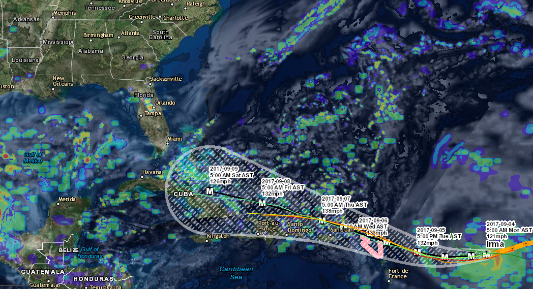
Hurricane Irma is now the 5th strongest Atlantic Hurricane on record with max winds of 185 mph. This makes Irma a very dangerous category 5 storm. The storm will begin impacting the Lesser Antilles Tuesday evening and Puerto Rico on Wednesday and on into the Dominican Republic on Thursday. Irma is expected to then move between the Bahamas and Cuba towards the weekend and will likely approach Florida into Sunday. The area in the Atlantic in Irma’s path is still conductive for further strengthening into the night on Tuesday. The direct impacts to the United States are still one of the unknowns, though Florida looks to be in the crosshairs no matter which model you are looking at. The track and impacts will be determined by the curve of the hurricane and when it decides to make the northerly turn. The Euro is trending towards a curve into Florida, while the GFS has been trending towards a turn before the storm completely reaches Florida. The track for Irma will be more certain by Thursday this week. We will continually monitor this system over the coming days with at least daily updates. Thanks for making SevereWXWarn your #1 source for severe weather!
Hurricane Irma (8:00 PM AST Tue Sep 5)
Location: 17.2°N 60.5°W
Moving: W at 15 mph
Min pressure: 916 mb
Max sustained: 185 mph
Download Our Hurricane Tracker On Apple
Download Our Hurricane Tracker On Android
Download Our Storm Tracker On Apple
Download our Storm Tracker On Android