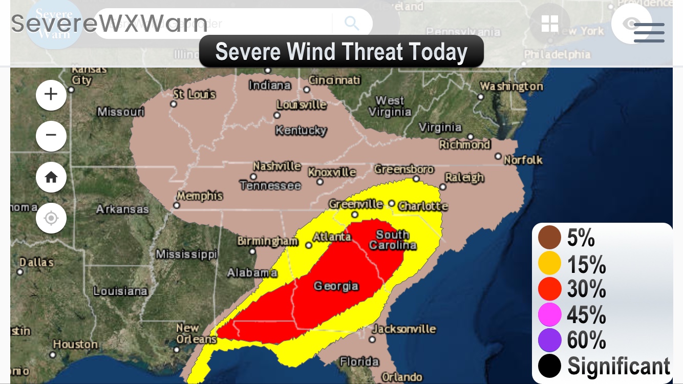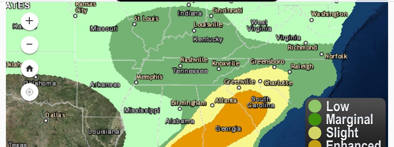
…SUMMARY… (From Storm Prediction Center at NWS)
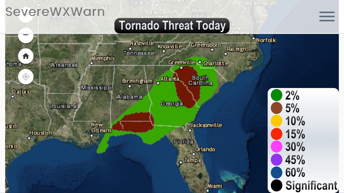
Damaging winds and a couple of tornadoes will be possible from the
northeast Gulf coast into parts of the Carolinas through this
evening. Isolated strong storms are possible centered over the
lower Ohio Valley this afternoon.
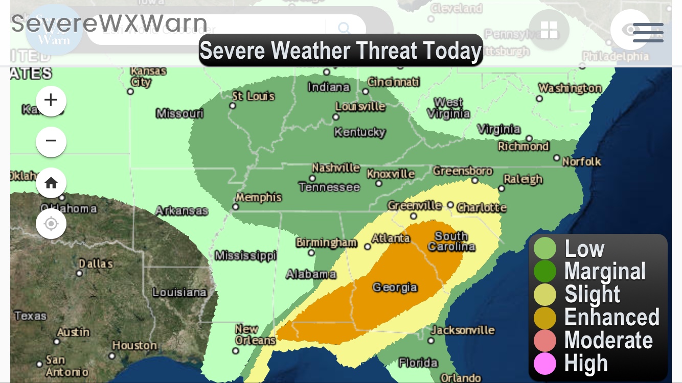
…Northeast Gulf coast to the Piedmont through this evening…
A midlevel trough now moving over MO/AR/LA will eject
east-northeastward to the OH Valley and southern Appalachians by
this evening, and continue to the Mid-Atlantic coast by the end of
the period. An associated surface cyclone will likewise develop
northeastward from MO to southeast Lower MI by 12z Tuesday. The
cold front trailing southward from the MO cyclone is somewhat
ill-defined this morning as a result of widespread pre-frontal
convection that now extends from central AL to extreme southeast MS.
This band of convection will likely persist through the day while
moving eastward across AL/GA and the FL Panhandle, where the
convection will be maintained by an influx of mid 60s to low 70s
boundary layer dewpoints from the northeast Gulf of Mexico.
Low-midlevel flow/shear will remain fairly strong but largely
line-parallel across southeast AL/southwest GA/FL Panhandle, which
will support occasional damaging gusts and some embedded
circulations in the line.
The northern extent of the squall line will initially remain along
the northern edge of the surface-based instability, but closer to
the path of the midlevel speed max. The convective band will
encounter a secondary corridor of low-level moisture/confluence from
the FL Atlantic coast northward along the Savannah River valley by
early afternoon, where additional scattered thunderstorm development
is possible. Somewhat greater buoyancy and storm mergers into the
squall line, as well as more line-normal low-midlevel shear
orientation for north-south line segments, should result in an
increase in the damaging wind risk from eastern GA into SC this
afternoon. Also, the more discrete cells ahead of the line could
become supercells capable of producing a couple of tornadoes.
Storms will begin to weaken this evening as the boundary layer
stabilizes gradually, and the midlevel wave begins to pass north of
the remaining unstable warm sector.
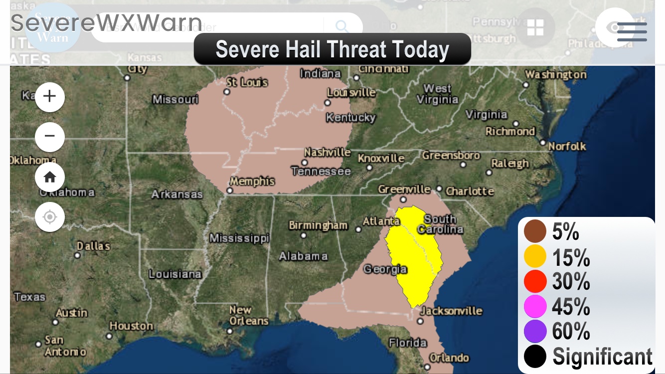
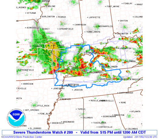
…Southeast MO to the lower OH Valley this afternoon/evening…
Residual boundary layer dewpoints in the 55-60 F range and surface
heating in cloud breaks could support weak buoyancy and the
potential for scattered thunderstorms this afternoon/evening along
and just ahead of the surface cold front. Marginally severe hail
and strong outflow gusts will be the main threat with these storms.