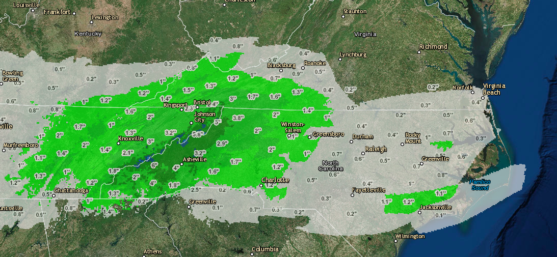
Here at SevereWXWarn we first broke the news of this system about 2 week ago and predicted that a system was likely, but not 100%. This system at the time was only showing up on a handful of models. This system has been a difficult system to predict as far as snowfall totals go, because if the system follows a more southerly track it will be all rain, but the farther north it tracks the more snow we could see. This morning the GFS and CMC model runs are continuing to show this system tracking farther north, which means more areas will likely see snow. We have posted our best guess as to who will see snow in North Carolina below. We will continue to provide updates on this system throughout the weekend and update any amounts as we see fit to change them. Please be sure to like us on Facebook to receive updates on future severe weather systems. Also be sure to download our Snowfall Forecast Applicaton on Android and Apple. We will also answer any questions you may have via Facebook. You can also use the social media buttons above to share this article with friends and family. Thanks for continuing to make us the #1 weather provider for the Carolina’s and a top contender on the national level as well.