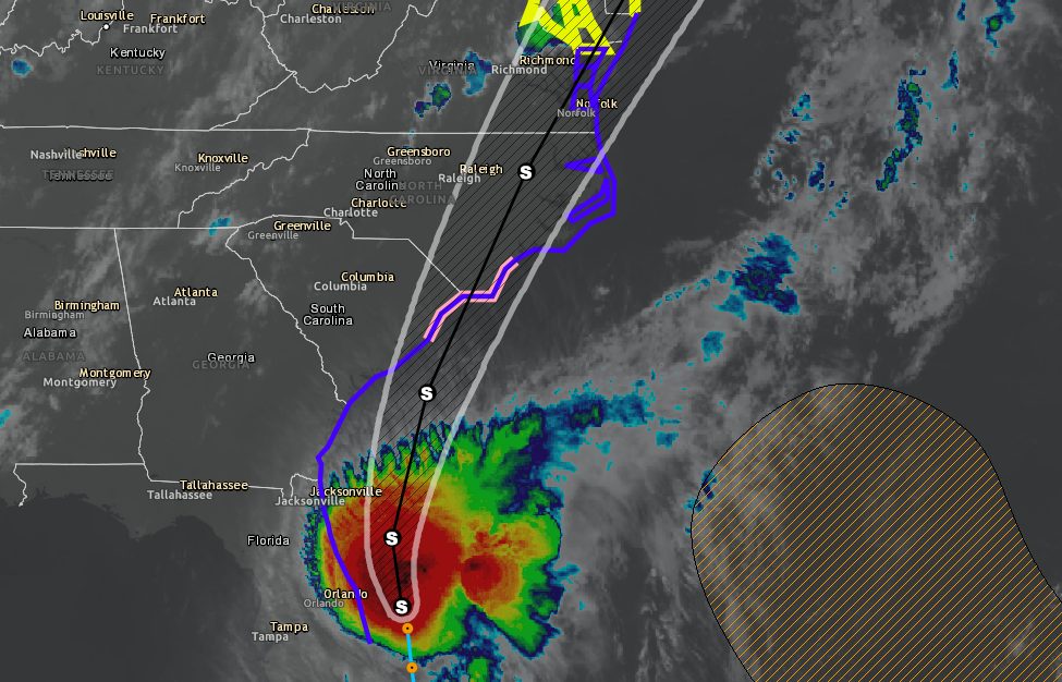
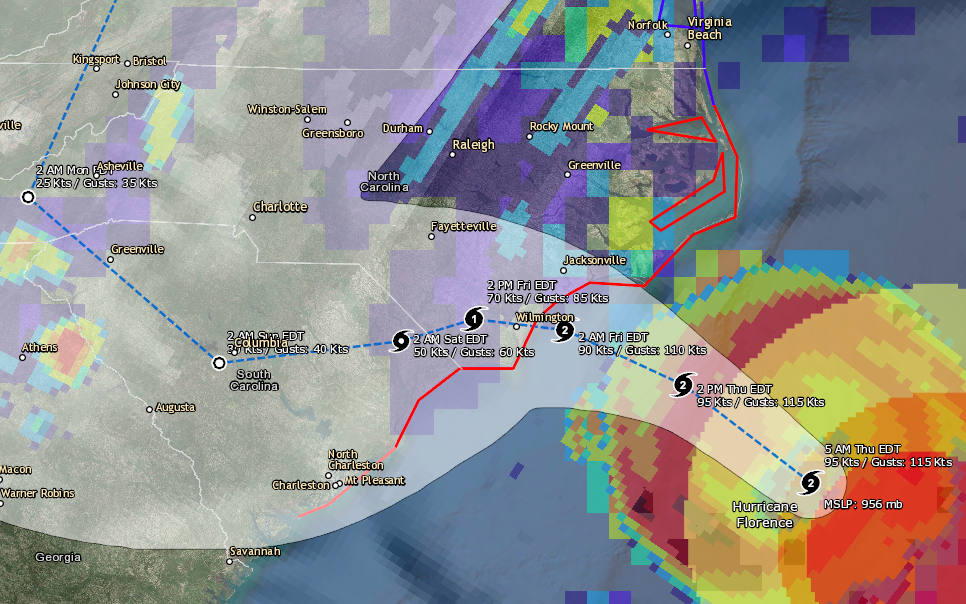
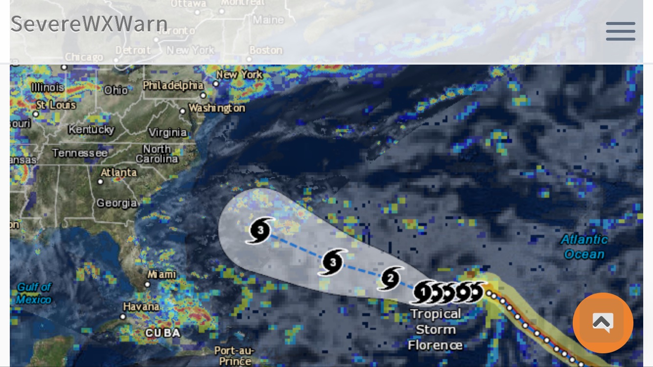
Tropical Storm Isaias is currently just off the eastern coast of Florida and is expected to make its way up the eastern coast over the next few days. The storm is expected to remain a strong tropical storm and will likely make landfall somewhere near the North and South Carolina boarder around midnight on Monday. Isaias currently has winds near 70 mph with higher gusts and is moving northwest at 9 mph. Tropical Storm watches and warnings has been posted for much of the southeaster US from Florida to Virginia. Some tornadoes will also be possible with this system. Please be sure to monitor the system in combination with the local NWS and NHC, as well as the resources available on our site and our mobile apps.

Storm Surge:
2-4 ft - Edisto Beach SC to Cape Fear NC
1-3 ft - Sebastian Inlet FL to Edisto Beach SC
1-3 ft - North of Cape Fear NC to Kiptopeke VA including Pamlico Sound,
Albemarle Sound, Neuse River, Pamlico River, Chesapeake Bay and
the Tidal Potomac River

Precipitation:
1-2 in - Eastern Florida & Coastal Georgia
3-6 in - Carolinas and the mid-Atlantic
2-4 in - Southeast New York and New England

Download our Hurricane Tracker (Apple)
Download our Hurricane Tracker (Android)
View our Hurricane Tracker (Desktop)