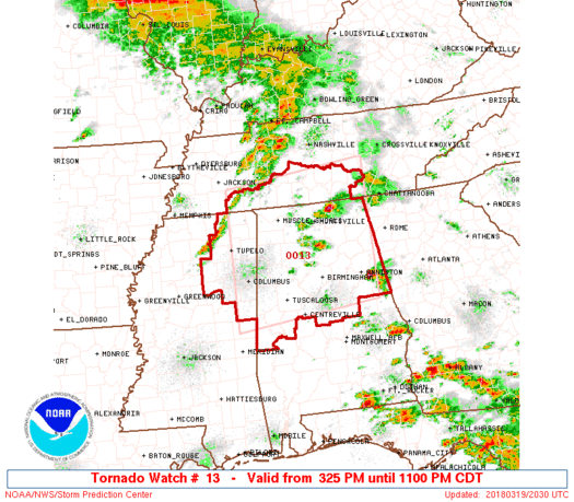

WW 13 TORNADO AL MS TN 192025Z – 200400Z

URGENT - IMMEDIATE BROADCAST REQUESTED
Tornado Watch Number 13
NWS Storm Prediction Center Norman OK
325 PM CDT Mon Mar 19 2018
The NWS Storm Prediction Center has issued a
* Tornado Watch for portions of
Northern and central Alabama
Northeast Mississippi
Southern Tennessee
* Effective this Monday afternoon and evening from 325 PM until
1100 PM CDT.
...THIS IS A PARTICULARLY DANGEROUS SITUATION...
* Primary threats include...
Several tornadoes and a few intense tornadoes likely
Scattered large hail and isolated very large hail events to 3
inches in diameter likely
Scattered damaging wind gusts to 70 mph possible
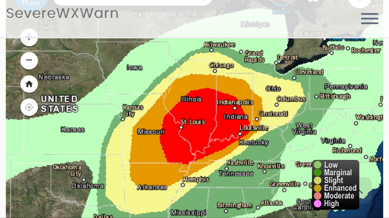
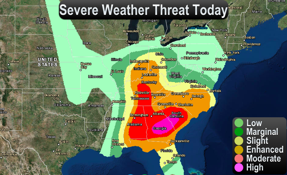
SUMMARY...Several severe storms will develop along a cold front
through this evening producing strong tornadoes, very large hail,
and damaging winds.
The tornado watch area is approximately along and 95 statute miles
north and south of a line from 15 miles south of Tupelo MS to 45
miles northeast of Gadsden AL. For a complete depiction of the watch
see the associated watch outline update (WOUS64 KWNS WOU3).
PRECAUTIONARY/PREPAREDNESS ACTIONS...
REMEMBER...A Tornado Watch means conditions are favorable for
tornadoes and severe thunderstorms in and close to the watch
area. Persons in these areas should be on the lookout for
threatening weather conditions and listen for later statements
and possible warnings.
&&
AVIATION...Tornadoes and a few severe thunderstorms with hail
surface and aloft to 3 inches. Extreme turbulence and surface wind
gusts to 60 knots. A few cumulonimbi with maximum tops to 500. Mean
storm motion vector 25040.
...Grams
Read more
Source: SPC