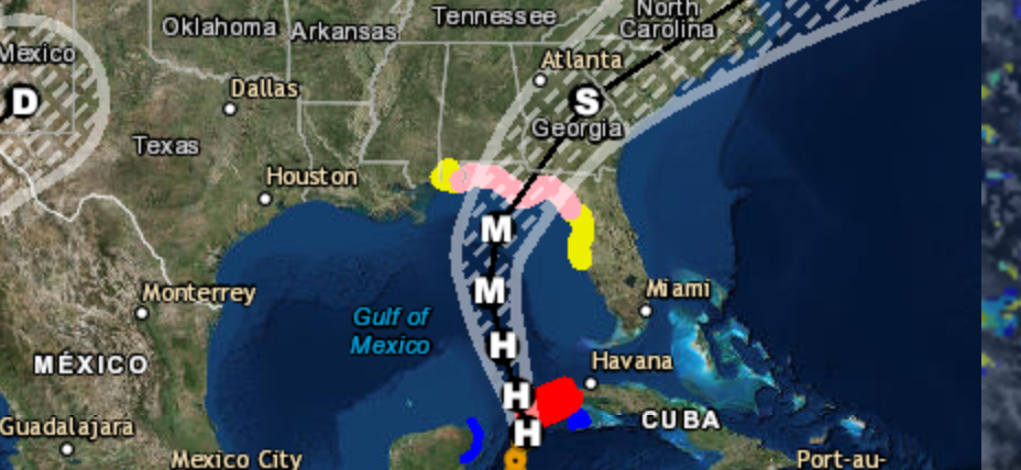
We here at SevereWXWarn took images provided by ESRI & USGS that were taken from a satellite known as LandSat 8 and modified the coloring to better show algae blooms currently in the Chowan River. We have provided that image below and have pointed out the major algae bloom areas on the map. As you can see from the map most of the algae blooms are on the south and west sides of the river in the area on Bachelor Bay. These images were taken on August 3, 2015 by the LandSat satellite. We also checked further down stream to find that most of the algae is located in this particular area and didn’t find any major blooms elsewhere in the river or sound. Algae blooms in this area typically peak in August and September. We will continue to monitor algae in the area, but it is best not to swim in areas where algae is visible. Be sure to use the social media share buttons above to share this article and like us on Facebook to stay up to date on this and more.

