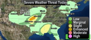
It’s officially April and with that typically comes severe weather and this week has already proven to be a dangerous week with severe weather including tornadoes, large hail and wind damage throughout the southeastern US. The setup this week will bring us more severe weather in the coming days. Be sure to use the free links and application downloads that we offer to stay alert and safe during severe weather.
Download our Storm Tracker on Android – Click Here to Download
Download our Storm Tracker on Apple Devices – Click Here to Download
View our Storm Tracker on our Website – Click Here to View
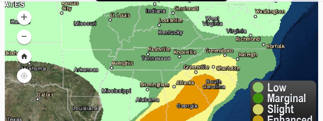
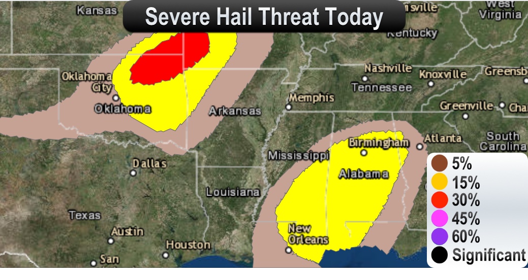
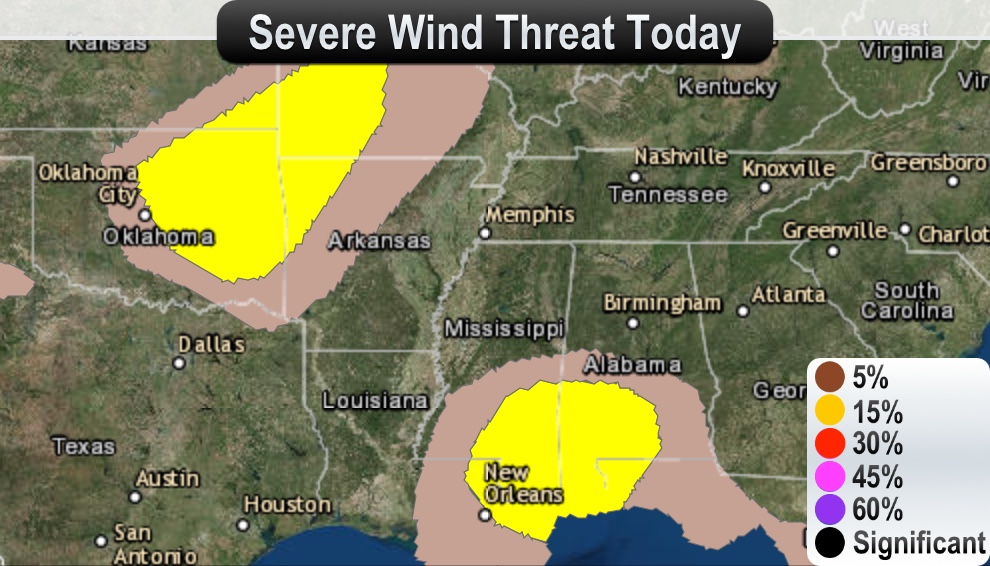
Today:
A vigorous mid/upper trough and attendant powerful jet over the
Intermountain West will migrate eastward over the central Plains in
the afternoon and evening. As this occurs, southwesterly mid-level
flow will strengthen across portions of the southern Plains and
eventually the lower- and mid-Mississippi Valley regions. At the
surface, a low – initially over western north Texas – will deepen
some while migrating northeastward across central Oklahoma and into
southwestern Missouri by the end of the period. Late in the period,
a warm front along the Gulf Coast will migrate inland to portions of
central Mississippi and Alabama by the end of the period. (-Storm Prediction Center)


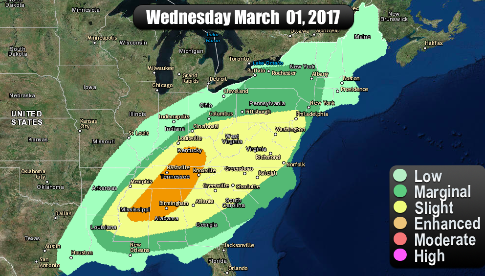
Tomorrow:
An outbreak of severe thunderstorms is possible across much of the
Southeast, northward along and west of the Appalachians into the
Ohio Valley, Wednesday through Wednesday night. This is expected to
include supercell development with a risk for tornadoes, some of
which could become strong and long-lived, particularly across parts
of the Southeast. (-Storm Prediction Center)
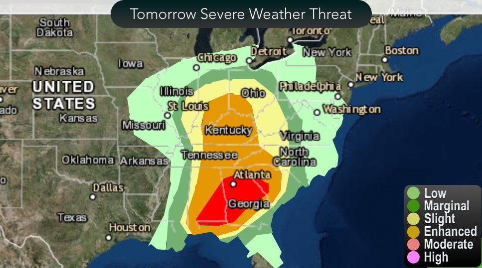
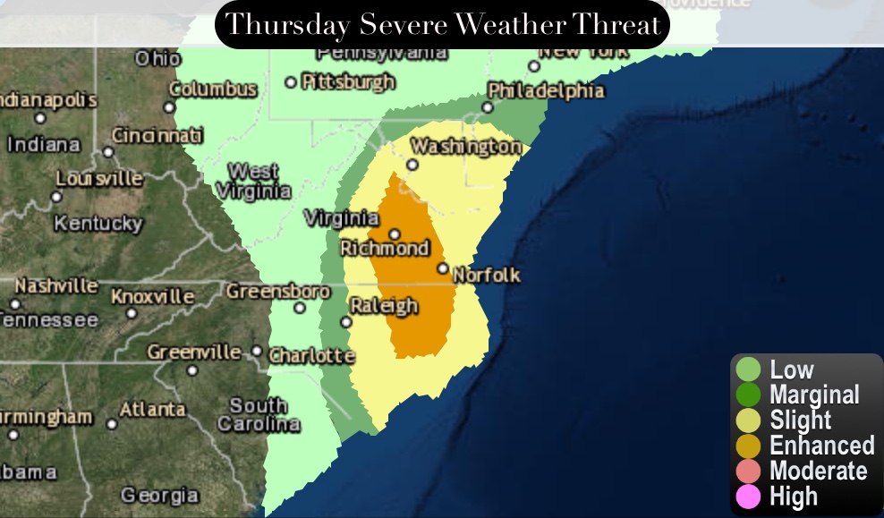
Thursday:
Organized severe storm development is possible across parts of the
Mid Atlantic Coast region Thursday, mainly prior to the 2-4 pm EDT
time frame. This includes a risk for supercells with potential for
tornadoes, and perhaps a narrow evolving squall line accompanied by
potential for damaging surface gusts. (-Storm Prediction Center)
