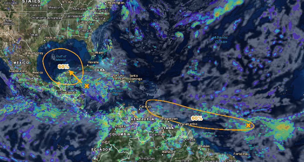
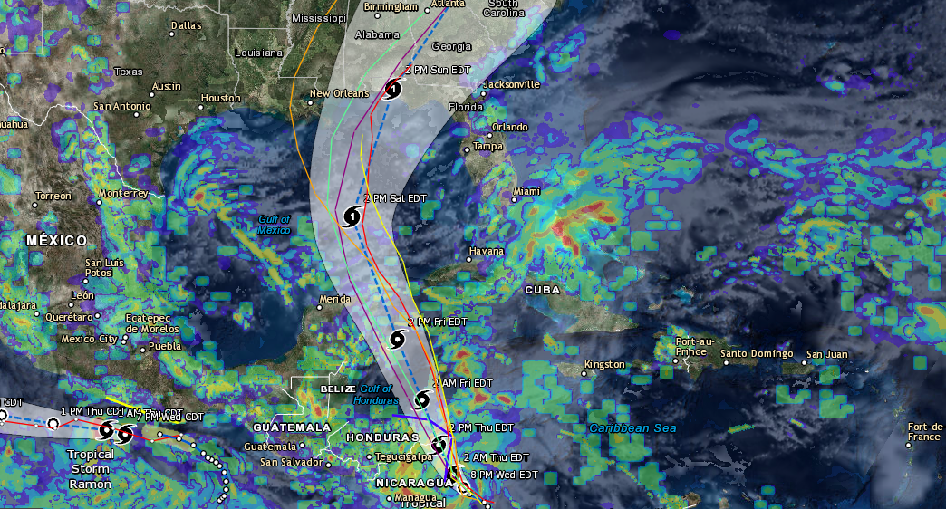
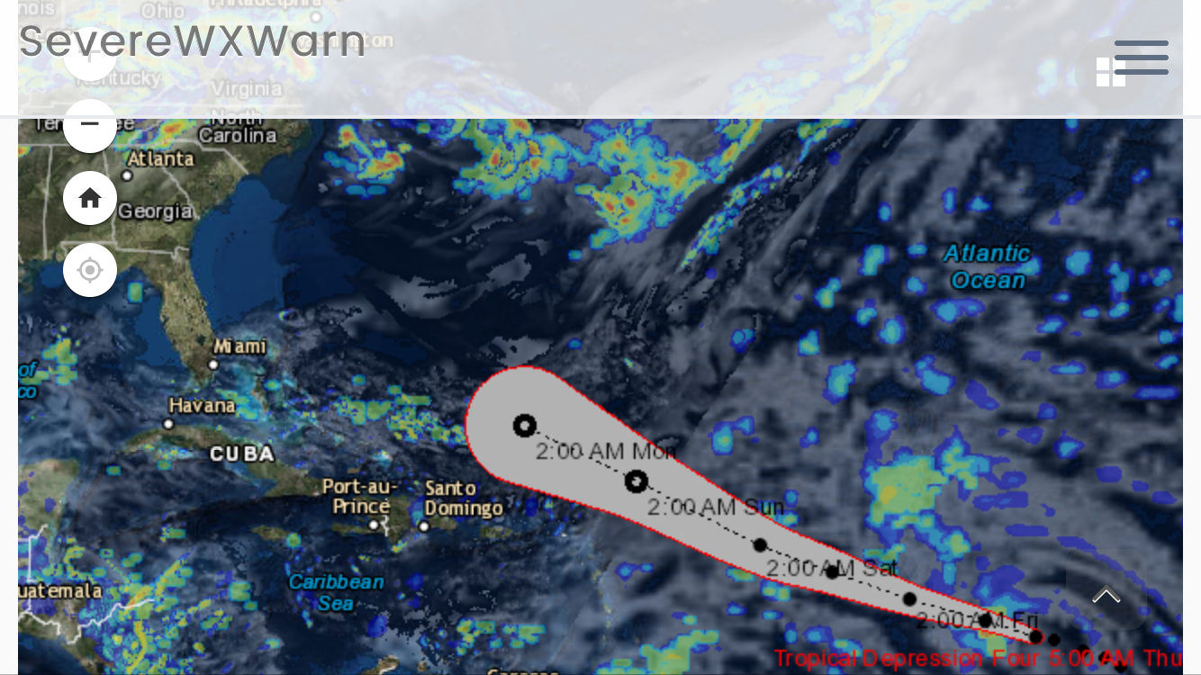
Hurricane Matthew has been strengthening rapidly over the last couple of days and it could possibly pose a threat to the east coast of the United States next week. Since our update earlier today the track has shifted slightly to the west and has strengthened from a category 3 storm to a category 4 storm making it the strongest Atlantic Hurricane so far this year. As of now the storm is still traveling to the southwest, but will likely make a sharp northerly turn on Saturday night. With the new track this storm is expected to make landfall in Jamaica on Monday likely as a major hurricane. The storm will also likely impact Haiti with high winds, rain and storm surge on Monday. This storm will also likely impact Cuba on Monday into Tuesday as a major hurricane. The storm is expected to fluctuate over the next few days, but will still remain a major hurricane. The track of this storm will put it a few hundred miles off the east coast of Florida on Wednesday slightly to the east of the Bahamas. The track of this storm after Wednesday is still up in the air, but it could likely be a threat to the east coast of the US. We will have a better idea on Sunday into Monday on the track of this system. It will likely hinge on when this system decides to make that hard north turn. We will provide more updates on this storm at least once daily and if the storm is going to impact the United States we will provide around the clock coverage.
If you would like to stay up to date on these systems and future systems be sure to like us on Facebook and download the Atlantic Hurricane Tracker on Android and Apple devices.
Facebook: www.facebook.com/severewxwarn
Hurricane Tracker(Apple): Atlantic Hurricane Tracker
Hurricane Tracker(Android): Atlantic Hurricane Tracker
Hurricane Tracker(Desktop): http://www.severewxwarn.com/atlantic-hurricanes/