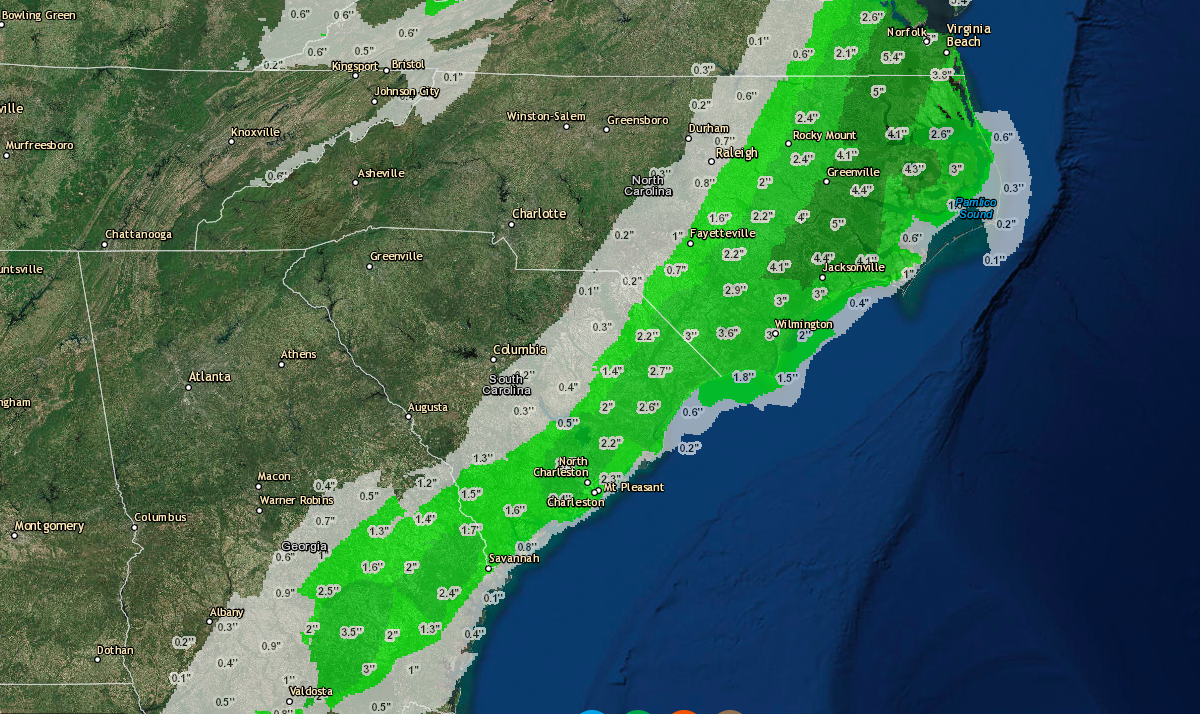
Snow will begin falling Friday in Eastern North Carolina around 4 a.m. Friday morning and will continue to snow in the eastern portion of the state until around 7 p.m. on Friday with the heaviest bands of snow falling during this period. There could be a few showers that push through after this, but most of the accumulation will occur from 4 a.m. to p.m. throughout the area. The largest impacts as far as snow totals go will be in the areas of Edenton and Elizabeth City, which could get as much as 3-6″ of snow on Friday. Some of the surrounding areas in Currituck, Camden, Pasquatank, Bertie, Washington, Beaufort, Tyrell and Dare counties could see 2-3 inches of accumulation as well. Further out towards raleigh (central) and in the southeastern portions of the state could get up to 1″. Be sure to like us on Facebook by clicking here and also be sure to check out our snowfall tracker map available for free on this site as well as on the Android and Apple App stores. All of these can be found in the top menu. Thanks for making us your #1 source of severe weather.