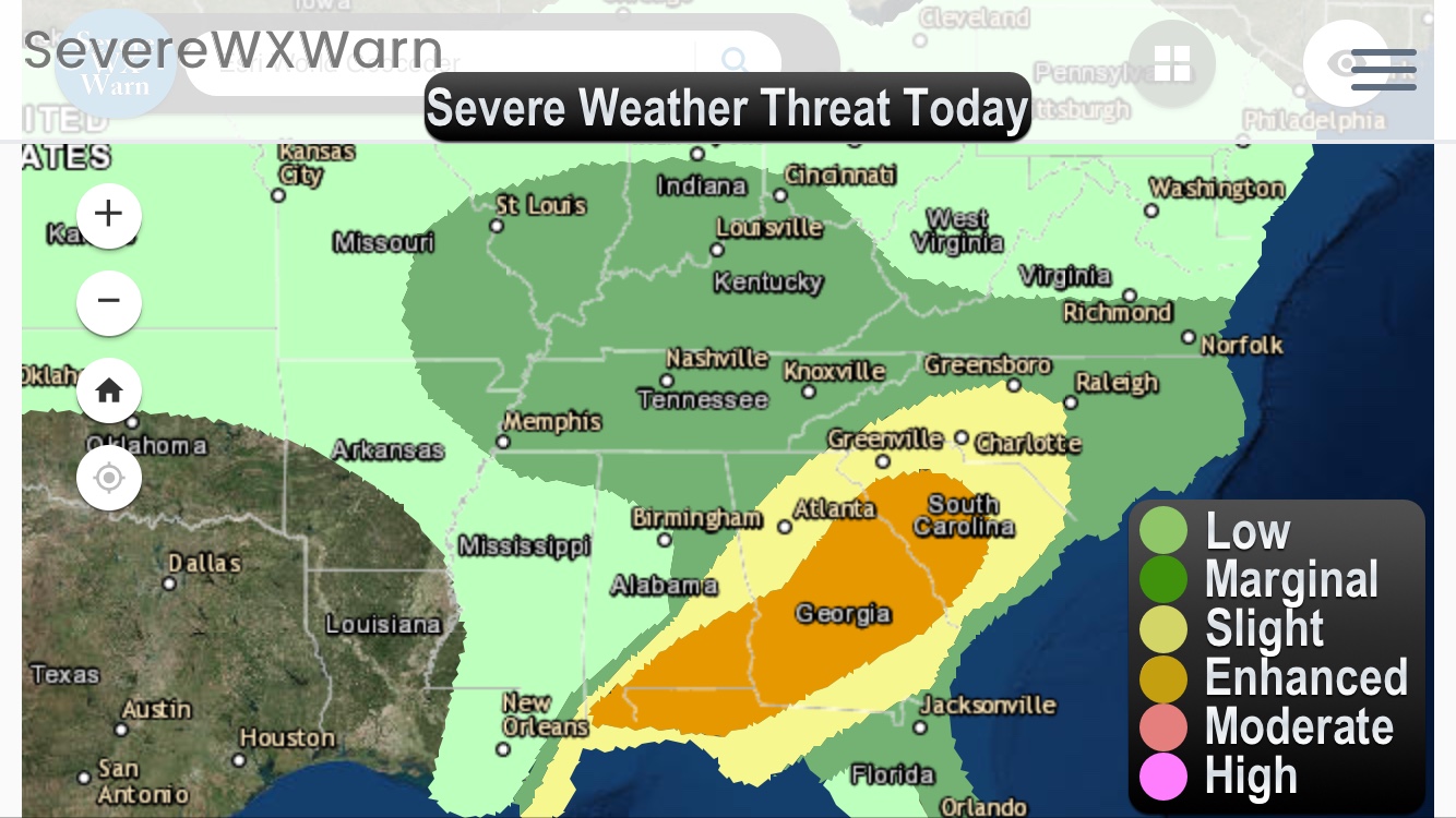
The same system that will be dropping massive amounts of snowfall throughout the Western and Central US this week could also bring an enhanced risk of severe weather to parts of the Southeastern US and Mid-Atlantic states. An enhanced risk of severe weather means that there could be damaging winds and hail accompanied with the storms and also a slight risk of some tornadoes. Large hail greater than 2″ in diameter is possible. Below we have posted the comentary from the NWS as long as a map and information on the map. This system will likely have impacts in a severe form on Tuesday and Wednesday for these areas. We will update on this system likely on the morning on the severe weather. To stay up to date on this system and more please be sure to like us on Facebook by CLICKING HERE and also be sure to get familiar with our storm tracker available on our site, Apple and Android. You can find links to all of these in the top menu. Thanks for making us your #1 source for weather.
From NWS:
…SUMMARY… SCATTERED SEVERE STORMS CAPABLE OF DAMAGING WINDS AND A FEW TORNADOES ARE POSSIBLE ACROSS THE LOWER MISSISSIPPI VALLEY INTO THE LOWER OHIO VALLEY ON TUESDAY WITH A FEW STRONG STORMS ACROSS THE CENTRAL GULF COAST OVERNIGHT.