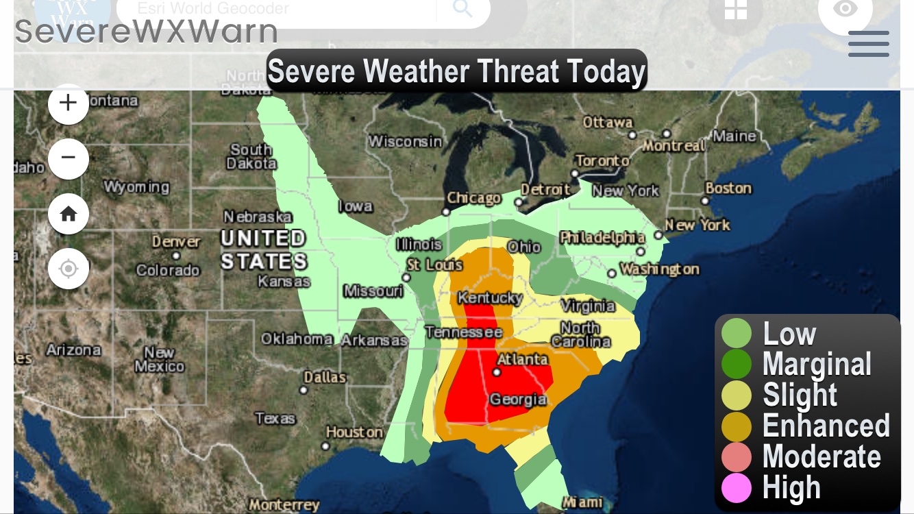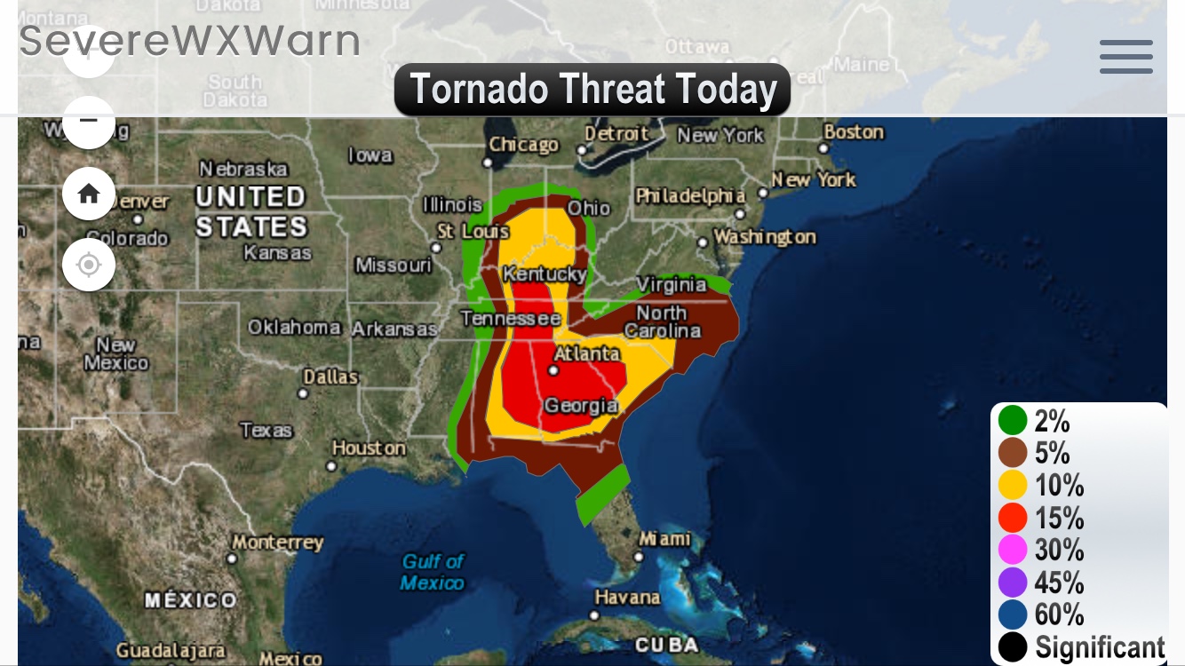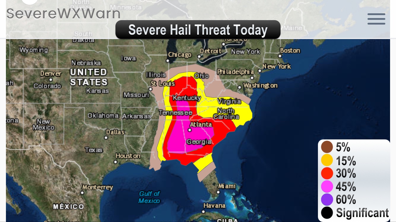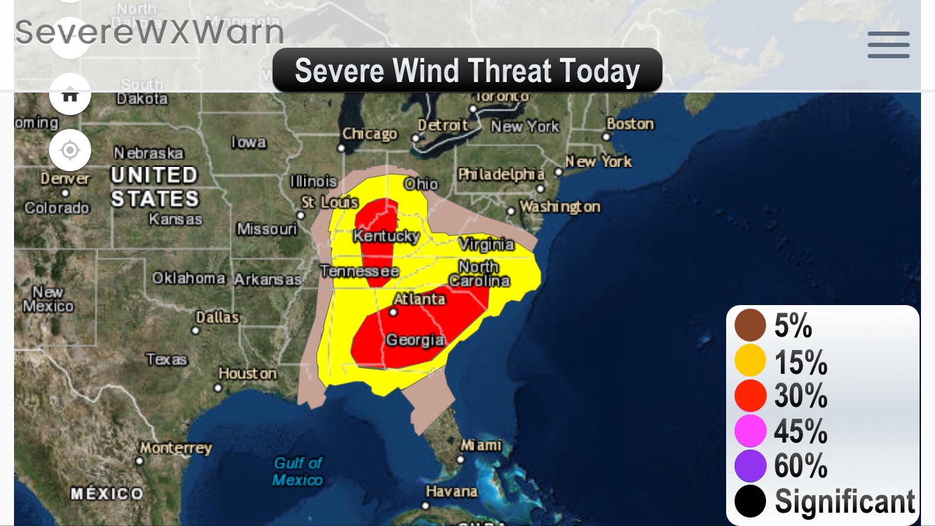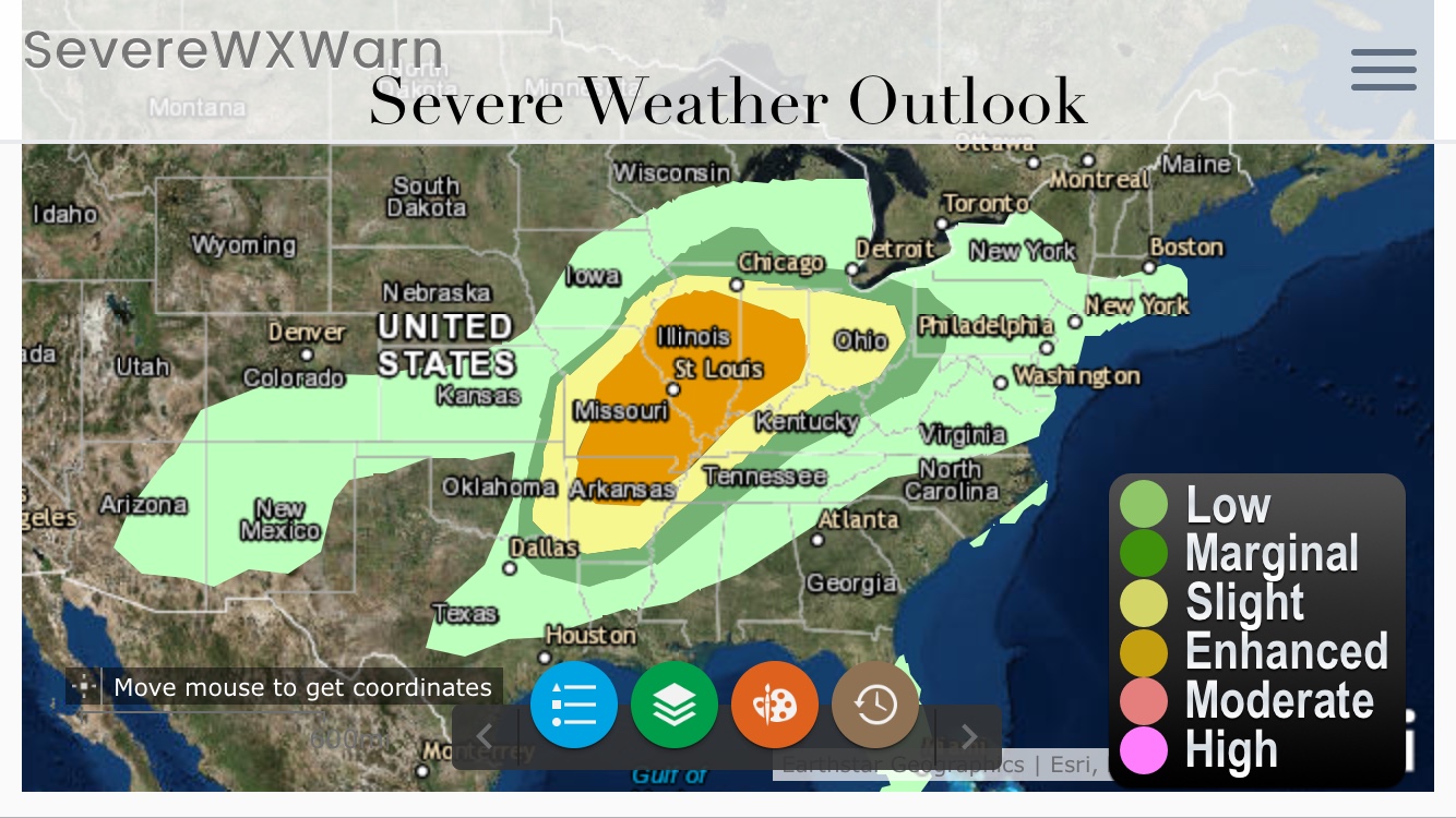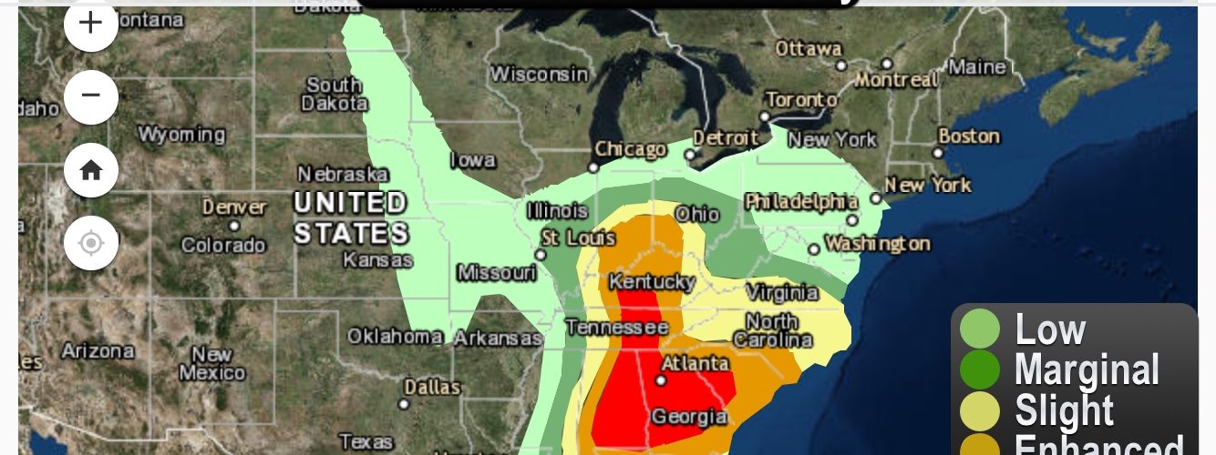
An outbreak of severe weather is likely today and with that it will bring a chance for a few strong tornadoes, large hail and some damaging winds. There is currently a moderate risk for severe thunderstorms today for Eastern Alabama and across Georgia and parts of western South Carolina onward through Eastern Tennessee and Southern and Central Kentucky. There is an enhanced risk for severe weather from the Ohio Valley into the Carolina’s and along the Northeast Gulf Coast. The surrounding areas will also have a risk for severe weather throughout the afternoon and night, though the chances will be lower. Storms can be expected to form in Missouri this evening as well as in Ohio moving into the Southern Appalachians overnight. The storms should progress through middle Tennessee and Central Alabama by late evening. The storms will then progress into Georgia and the Carolina’s overnight bringing a chance for pretty decent supercell development. The largest threat for storng tornadoes this afternoon/evening will be across Eastern Alabama, Georgia and West Central South Carolina. Overnight the storms will move eastward into across Georgia, South Carolina and North Carolina will some tornadoes, hail and severe winds being possible.
Download our Storm Tracker on Android – Click Here to Download
Download our Storm Tracker on Apple Devices – Click Here to Download
View our Storm Tracker on our Website – Click Here to View