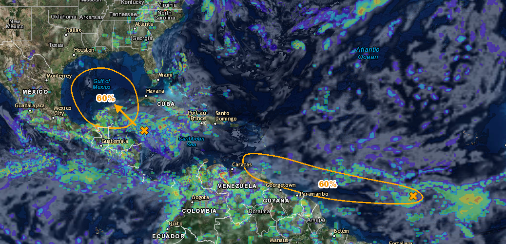
For the North Atlantic...Caribbean Sea and the Gulf of Mexico: 1. Satellite images indicate that an area of disturbed weather associated with a tropical wave is located about 1800 miles east of the southern Windward Islands. This disturbance has become better organized today, and additional development is possible during the next day or two before conditions become less favorable for tropical cyclone formation. This system is expected to continue moving toward the west at 15-20 mph over the tropical Atlantic during the next several days. * Formation chance through 48 hours...medium...40 percent. * Formation chance through 5 days...medium...60 percent. 2. Surface pressures are falling in the western Caribbean Sea and the areal coverage of the disturbed weather has continued to increase. Conditions appear to be favorable for gradual development of this system while it moves slowly northwestward across the Yucatan Peninsula this weekend and into the south central Gulf of Mexico early next week. Regardless of development, heavy rains are likely to spread over portions of Central America, the Yucatan Peninsula and western Cuba during the next several days. * Formation chance through 48 hours...low...20 percent. * Formation chance through 5 days...medium...60 percent. -National Hurricane Center (NWS)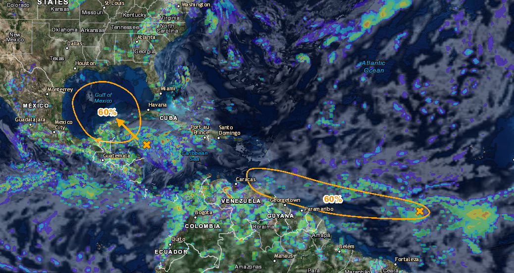
You may also like

Tropical Storm Erika is looking more organized and beginning to push west at a faster pace. Erika’s path is still a little […]
Storm Surge Watch Jupiter Inlet southward around the Florida peninsula to Bonita Beach Florida Keys Hurricane Warning Dominican Republic from Cabo Frances […]
An area in the Atlantic Ocean has a 90% chance of developing into a tropical system over the next 5 days. The […]
Hurricane Matthew has been strengthening rapidly over the last couple of days and it could possibly pose a threat to the east […]