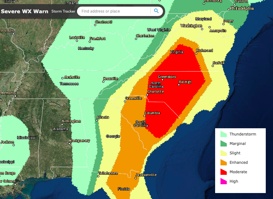
There is a moderate risk of severe thunderstorms today and this evening across the piedmont and eastern portion of the Carolina's and southern Virginia.
Severe thunderstorms with considerable potential for producing damaging wind gusts and a few tornadoes are expected across much of the southern through mid Atlantic Coast region, particularly across the Carolinas into southern Virginia late this afternoon and evening
This system is expected to contribute to weak to moderate boundary layer destabilization ahead of a cold front, which is forecast to surge eastward toward the south Atlantic coast by early afternoon, before advancing offshore and northeastward through the Mid Atlantic Coast region by late tonight. This environment is expected to become conducive to considerable organized severe thunderstorm development, accompanied by the risk for strong, damaging winds and a few tornadoes.
Beneath the mid-level cold core of the evolving system, scattered thunderstorm activity is also possible across parts of the lower Mississippi Valley vicinity late this afternoon and evening. Additional, widely scattered to scattered thunderstorm activity is possible ahead of a cold front advancing into the northern intermountain region and northern Rockies.
Southern through Mid Atlantic Coast region. There appears a substantial signal in model output, supported by current observations, that large-scale forcing for ascent ahead of the eastward advancing cold front may contribute to an evolving squall line across parts of northern/western Georgia into the northeastern Gulf of Mexico by 12Z this morning. The extent of inland boundary layer destabilization ahead of this activity, at least initially, remains unclear. However, coupled with insolation, boundary layer moistening is expected to support sufficient destabilization within the inflow region of the storms to support a gradual increase in intensity through midday, while activity advances toward the Savannah River, Georgia Atlantic coast, and Florida Gulf coast (near and north of Tampa Bay). Given the strength of the environmental wind fields, and the organizing convection, this likely will be accompanied by increasing potential for damaging wind gusts. At the same time, guidance is suggestive that an influx of boundary layer moisture across the Carolina coastal plain into the piedmont may be accompanied by moderate boundary layer destabilization.
In the presence of forcing for ascent aided by low-level warm advection, the initiation of discrete storms appears possible, perhaps including a few supercells accompanied by a risk for tornadoes. The discrete storms may persist and spread north-northeastward into Virginia, as the northern flank of the upstream squall line advances northeastward. In the presence of the aforementioned strong (and strengthening) lower/mid tropospheric wind fields, near the mid-level inflection point between the downstream ridge and upstream trough, there appears potential for further upscale growth and acceleration of convection across the Carolinas into southern Virginia during the peak late afternoon instability. Given ambient mean wind fields near 50 kt, severe convective gusts may become fairly widespread, with a few peak gusts in excess of 65 kt also seeming probable. While damaging wind gusts appear the main threat with the northeastward and eastward advancing line of storms, a few embedded tornadoes may also be possible.
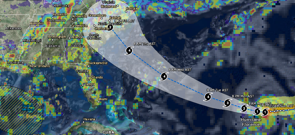
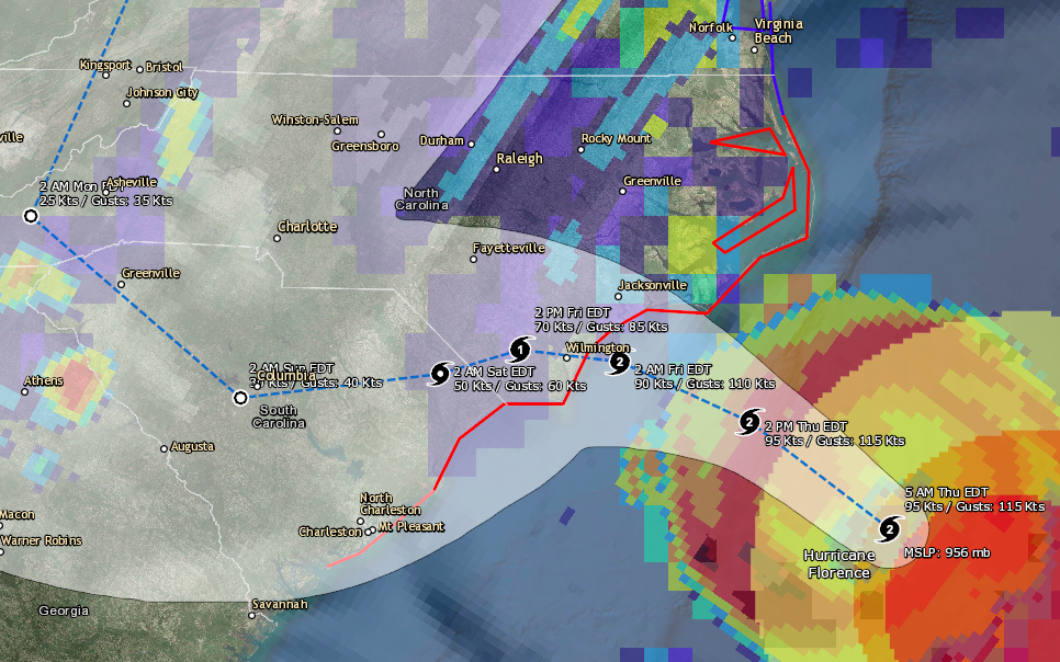
Hurricane Florence is forecast to rapidly intensify into a major category 4 hurricane before likely making landfall somewhere in the Carolina’s later […]


