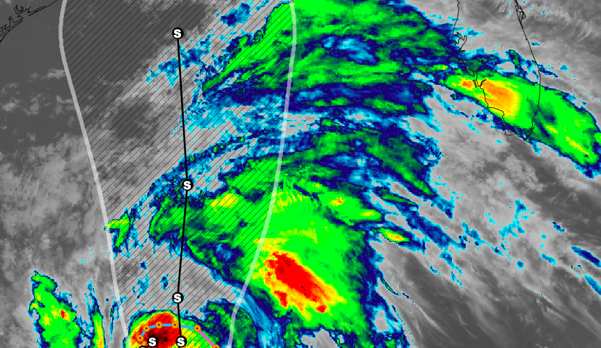
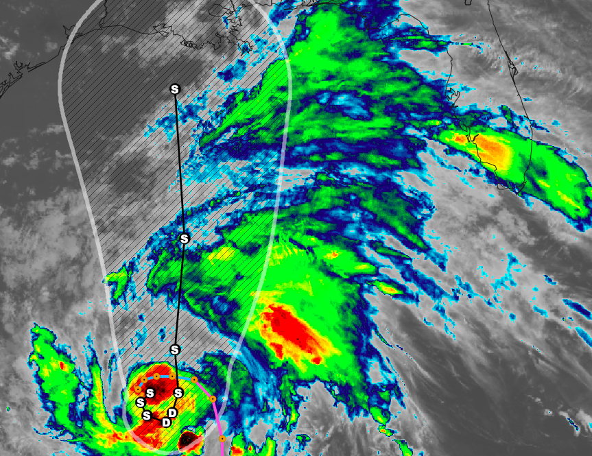
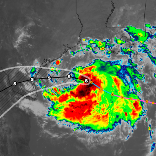
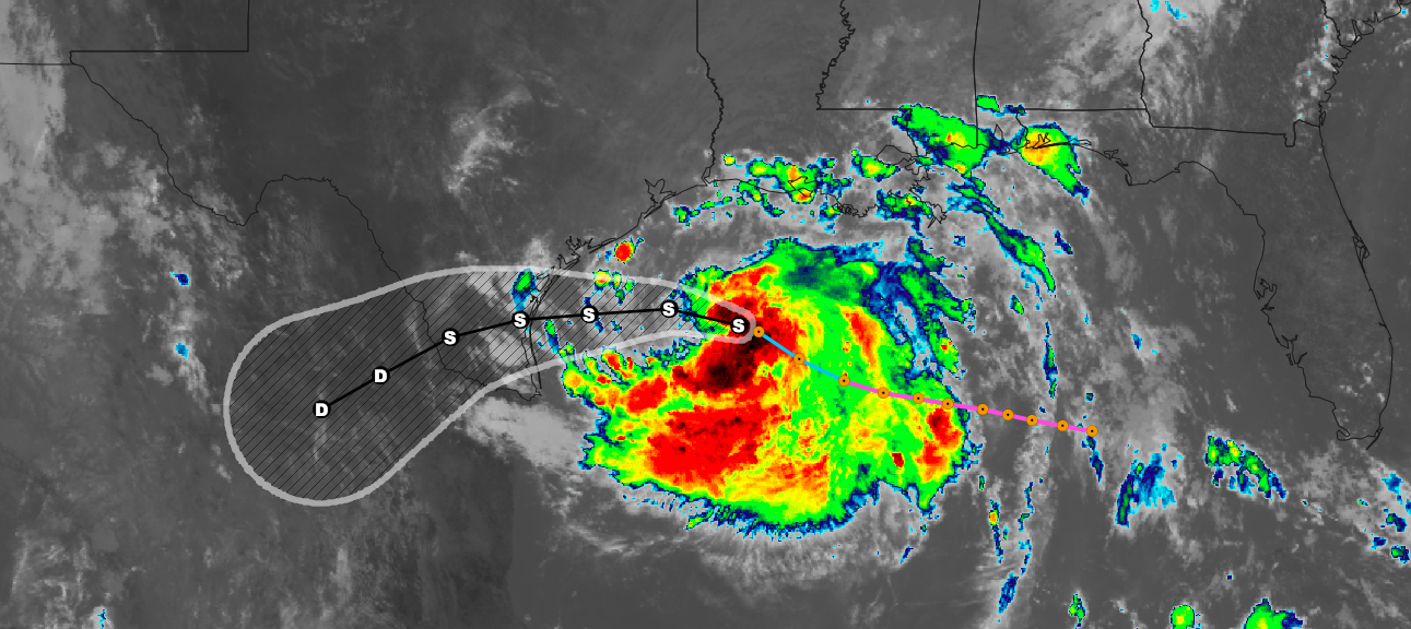
Tropical Storm Cristobal has formed in the Gulf of Mexico and was found to have slightly strengthened during the day on Tuesday. Current max sustained winds are near 45 mph with the storm moving south at 3 mph. A Tropical Storm Warning is in effect for Campeche to Puerto de Veracruz. A turn toward the southeast and east is expected tonight and Wednesday, followed by a turn toward the north-northeast and north on Thursday
night and Friday.  On the forecast track, the center will cross the southern Bay of Campeche coast on Wednesday and move inland over eastern Mexico Wednesday night and Thursday, and move back over the Bay of Campeche Thursday night and Friday. Some additional increase in strength is possible until the center
crosses the coast.  Gradual weakening is forecast while the center remains inland, but restrengthening is expected after Cristobal moves back over water Thursday night and Friday. Tropical-storm-force winds extend outward up to 85 miles from the center. Cristobal is expected to produce total rain accumulations
of 10 to 20 inches with isolated maximum amounts of 25 inches over parts of the Mexican states of Tabasco, Veracruz, and Campeche. Cristobal is also expected to produce total rain accumulations of 10
to 15 inches over northern Chiapas, Quintana Roo and Yucatan. Additional rainfall of 10 to 15 inches, with isolated amounts of 25 inches is expected along the Pacific coasts of Chiapas, Guatemala,
and El Salvador.  Some of these  Pacific locations received 20 inches of rain over the weekend, and storm total amounts of 35 inches are possible.  Rainfall in all of these areas may produce life-threatening flash floods and mudslides. Later in the week, increasing southerly flow should steer the system northward over the Gulf of Mexico and near the northern Gulf coast by the weekend. The official track forecast lies near the latest dynamical model consensus, and is roughly in the middle of the track guidance suite. Given the spread in this guidance, there is a significant amount of uncertainty in the NHC forecast at days 4-5.

Data sourced from: National Hurricane Center
