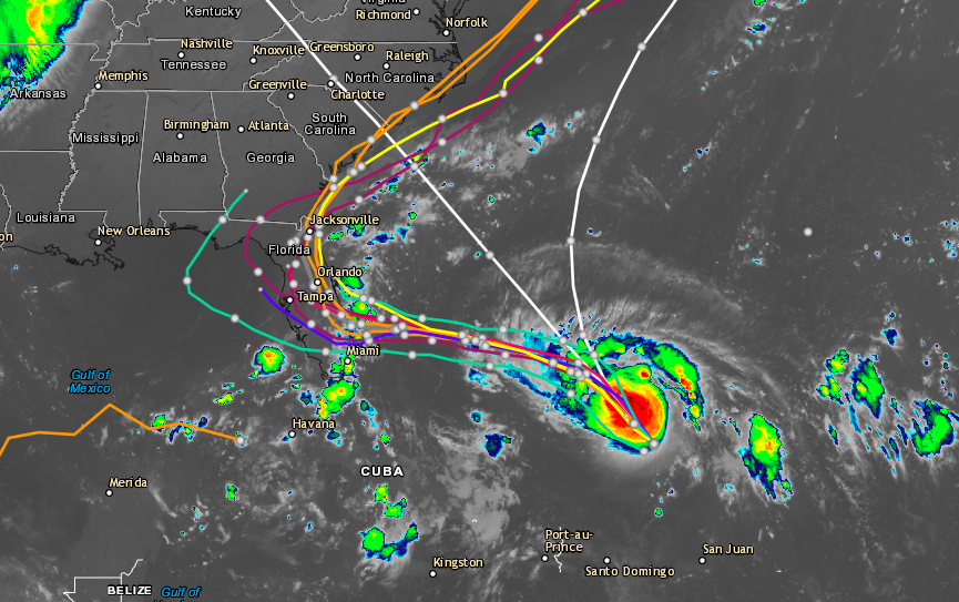
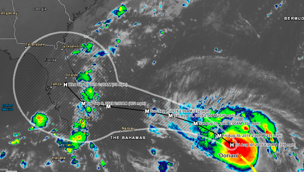
Hurricane Dorian strengthened some overnight and now has winds of 110 MPH and is moving northwest at 12 MPH. The storm is currently located about 250 miles from the Bahamas. A hurricane watch is now in effect for the northwestern Bahamas. Dorian is expected to become a major hurricane later today and continue strengthening throughout the weekend. Models are now giving us a better look at what the storm may do and the entire southeastern US should monitor this storm. The timeline of the storm means that the Bahamas should start feeling the effects on Saturday going into Sunday. Storm surge impacts of this storm could bring tides 10-15 feet above normal. Rainfall from major impacted areas of this storm could range from 6-15 inches. The new model runs this morning including the Euro and GFS show the storm making landfall in Florida then skirting the eastern coast from Florida to North Carolina. Please continue monitoring this system and thank you for choosing SevereWXWarn for all you severe weather needs.

Like us on Facebook
Download our Hurricane Tracker (Apple)
Download our Hurricane Tracker (Android)
View our Hurricane Tracker (Desktop)
